Greater Zurich does not use land parsimoniously: despite the spatial planning act, which has been in force since 1980
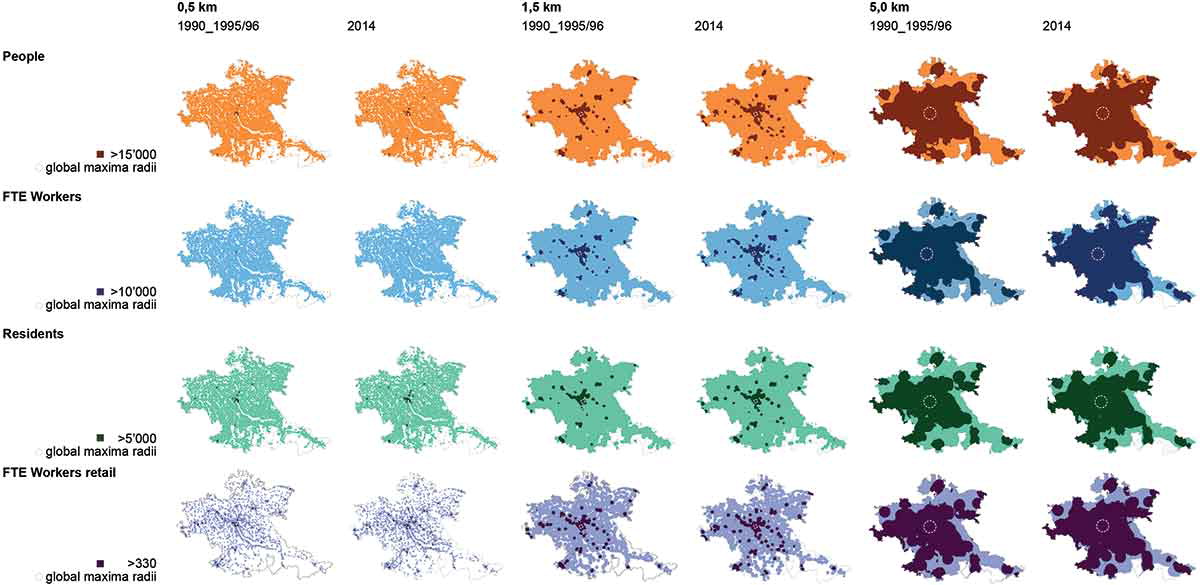
An overconsumption of land for building and urban use has resulted from rising incomes, falling transport costs, separating urban land use, restricting building heights and densities, and the lack of internalizing negative externalities. This paper empirically analyses whether land in Greater Zurich is used parsimoniously. Furthermore, it proposes changes in planning and policy that would be necessary to overcome the implementation deficit of the federal Spatial Planning Act (RPG). The analysis measures the distribution and mix of residents, workers, and retail workers and the change in land use. It also examines the relationship between public transport and building zones. Consequently, although intensification in residents has occurred since 1990 and workers since 1995/96, the distribution of residents and workers at central locations indicates that land in 2014 is used neither sufficiently intensively nor in a balanced way. Therefore, in Greater Zurich, price-based regulations need to supplement the current purely quantity-based regulations.