4D-Geodesigning urban transformation
The teaching project addresses the issues of urban planning. Students actively engage with building and zoning regulations.
This planned course addresses the crucial urban transformation issues of our time at the 10-minute-neighbourhood level. The aim is to use technology, communication, as well as a combination of online educational materials for virtual interaction, complementing traditional place-based classroom methods. The project will be implemented in a Summer School (2022), as an integrated discipline in Prof. Klumpner's Design Studio "Urban Prototyping" on Kigali (HS22) and as an elective with exercises in Calgary (FS23) and in Zug (FS24). In addition, the online material can be used for self-paced learning.
(i) Students actively engage with building and land use regulations by reconstructing them in a 3D model, formulating new 3D regulations based on the design and land use criteria, as well as simulating possible developments based on the existing building criteria in 4D. As students from different disciplines work in teams and share knowledge through mutual work and peer reviews, they can learn from each other and thus expand their knowledge across disciplines.
(ii) Urban design lecturers can benefit from being relieved of the task of teaching students software as part of the design class.
(iii) All current degree programmes in architecture, landscape architecture, building information systems (all D-ARCH), along with spatial development and infrastructure systems (D-BAUG) can benefit from this. It is also likely that, on this basis, a joint degree programme will be offered in the future, offering a combination/integration of additional software, e.g., City Energy Analysis (CEA) by Prof. Schlütter, IÖ-app by Prof. Menz, Enerpol Tool/Daylight by Prof. Klumpner, to name but a few.

4D-Geodesigning Urban Transformation 10-Minute-Neighbourhoods St. Gallen (FS25)
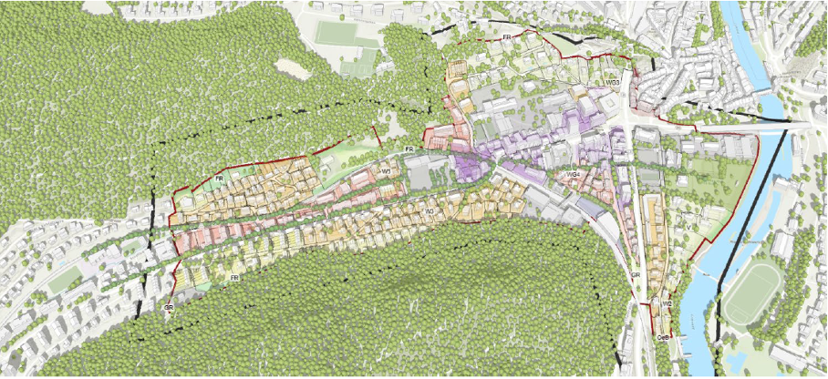
This semester we will use the City of St. Gallen as a case to study current land use and identify where and how current zoning by-laws would need to be changed, to enable 10-Minute-Neighbourhoods. The focus will be on growing up instead of outwards, and how this shift impacts urban design.
We will integrate existing land use regulations into ArcGIS Urban and design the necessary urban transformation to derive new urban planning guide lines. Our guests will include software developers, urban planners, design and development experts.
The Learning & Teaching Fair 2024 showcased 42 innovative teaching projects, serving as a source of inspiration and fostering an exchange of ideas for the ongoing development of teaching methods. In our 4D-Geodesigning Urban Transformation course, we foster student engagement through a dynamic blend of online and in-class activities. Leveraging cutting-edge technology, powered by ArcGIS, students actively participate in reconstructing and simulating web-based 4D urban models. Collaborative efforts across disciplines are encouraged through team-based projects, promoting mutual learning. Additionally, peer-review activities contribute to a vibrant exchange of ideas, ensuring students remain actively involved in the learning process.
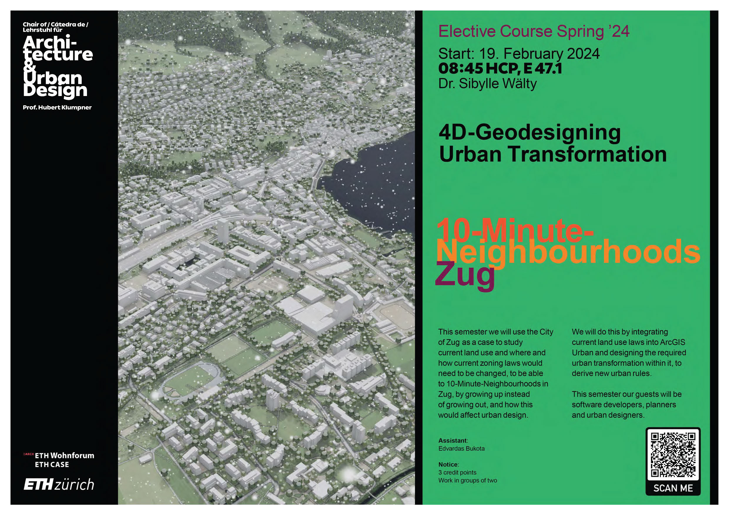
4D-Geodesigning Urban Transformation 10-Minute-Neighbourhoods Zug (FS24)
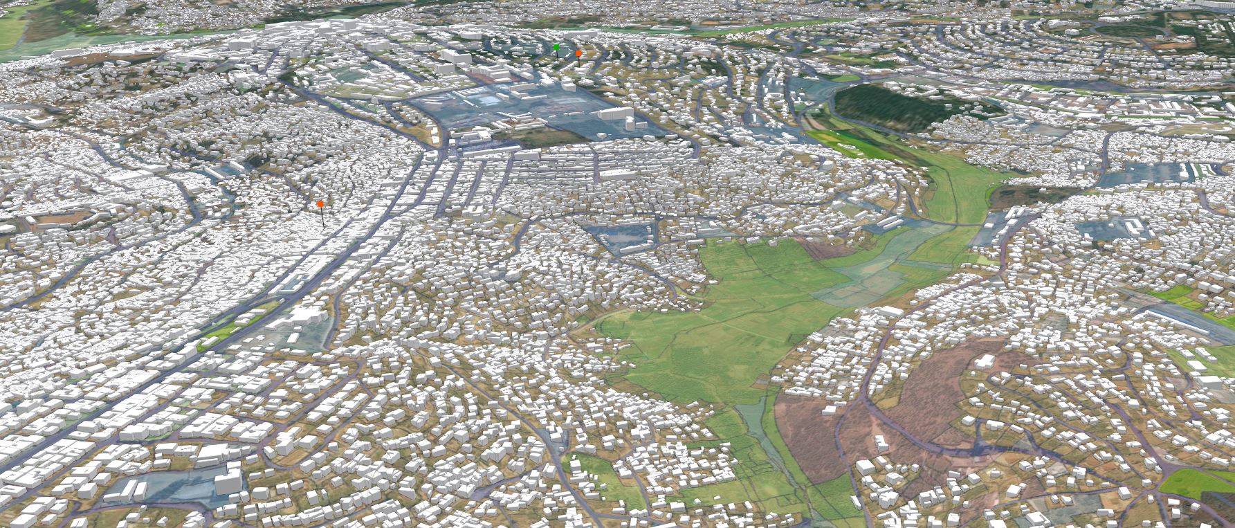
This semester we will use the City of Zug as a case to study current land use and where and how current zoning laws would need to be changed, to be able to 10-Minute-Neighbourhoods in Zug, by growing up instead of growing out, and how this would affect urban design.
We will do this by integrating current land use laws into ArcGIS urban and designing the required urban transformation within it, to derive new urban rules. This semester our guests will be software developers, planners and urban designers.
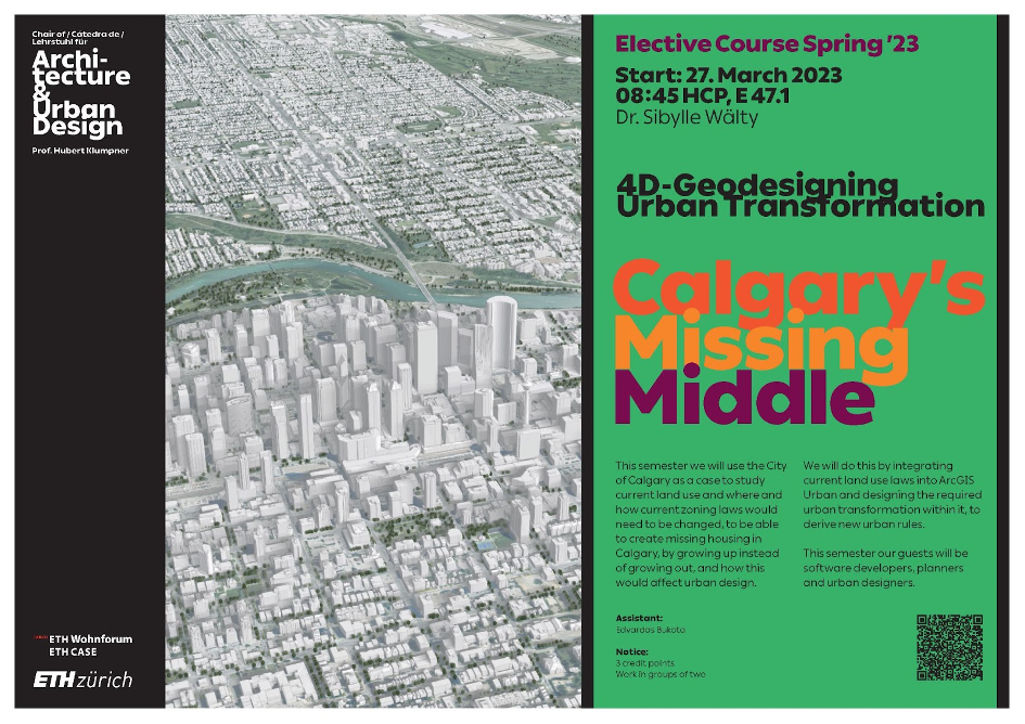
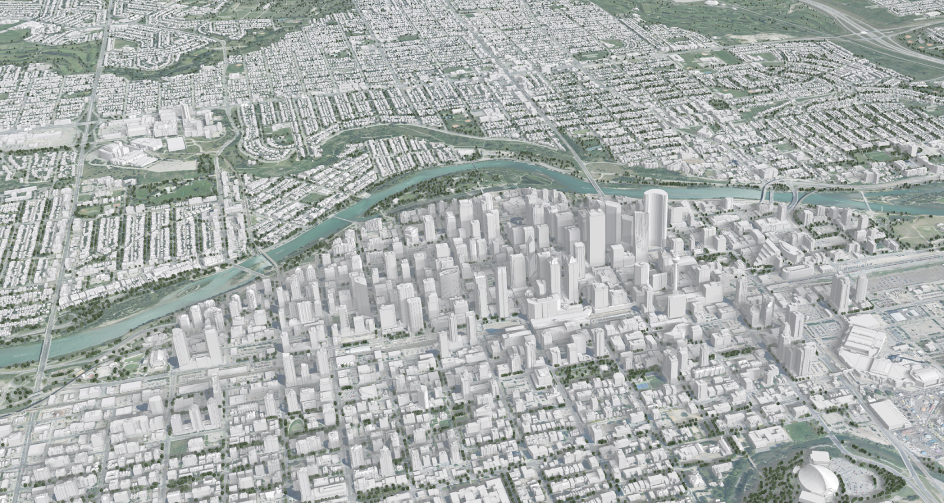
4D Geodesigning Urban Transformation Calgary's "missing middle" (FS23)
New Semester, new continent. Looking forward to 4D Geodesigning Urban Transformation Calgary's "missing middle".
This spring semester Students of the Departments of Architecture, Department of Civil, Environmental and Geomatic Engineering, and Departement of Environemental Science ETH Zurich will use the City of Calgary as a case to study current land use, where and how current zoning laws would need to be changed to be able to create missing housing in Calgary by growing up instead of growing out and how this would affect urban design.
We will do this by integrating current land use laws into #ArcGIS Urban and designing the required urban transformation within it to derive new urban rules.
Furthermore, the exchange with software developers, urban planners and urban designers is planned as our guests.
external page Collection StoryMaps Final Presentations
Guests:
- Alkarim Devani Co-founder of RNDSQR
- Kate van Fraassen RPP, MCIP Senior Planner, Land Use Bylaw, City of Calgary
- Troy Gonzalez Senior Planner, Community Planning, City of Calgary
- Dr. Christian Sailer through feedbacks as educational developer D-BAUG
- Peter Schryvers, MCIP, RPP Senior Planner, Community Planning, City of Calgary
- Till Schmid Product Engineer ArcGIS Urban @Esri R&D Center Zurich
- Prof. Francisco Alaniz Uribe University of Calgary
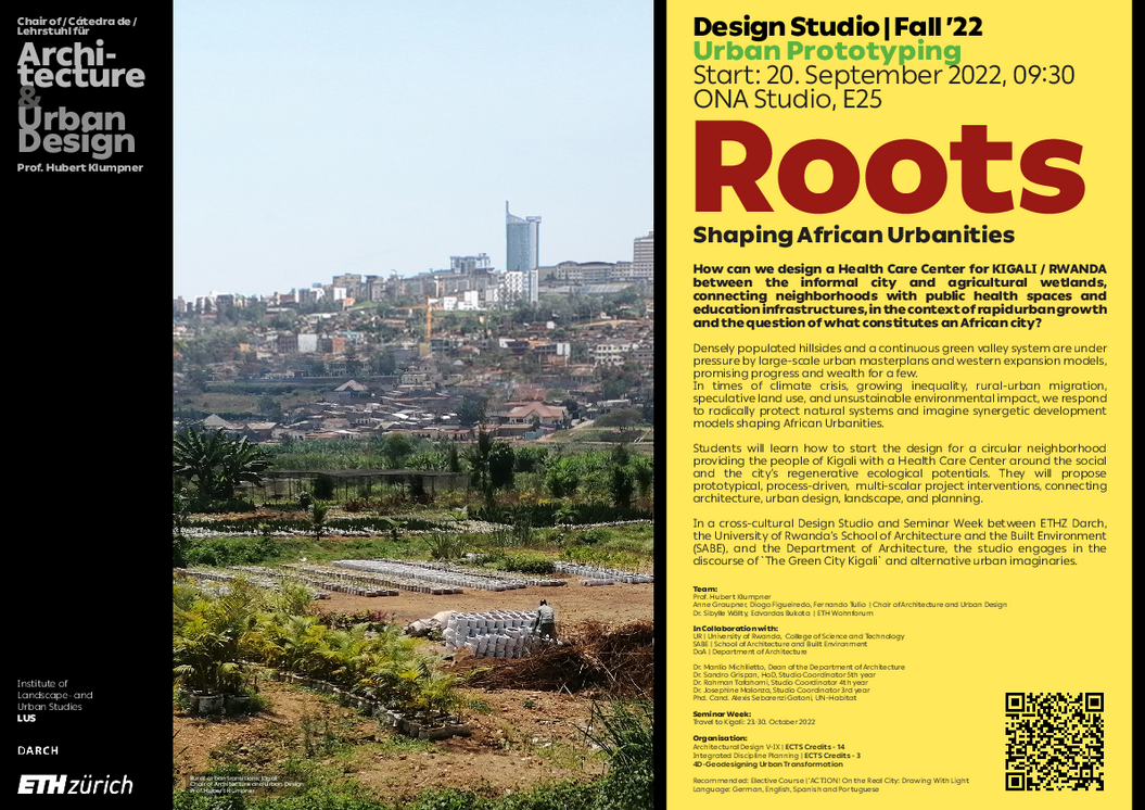
Integrated Discipline in Design Studio Prof. Klumpner "Urban Prototypin" to Kigali (HS22)
4D Geodesigning Urban Transformation as an Integrated Discipline Planning to Design Studio Kigali Prof. Klumpner (HS22) addresses critical urban planning issues in the city of Kigali, using new technologies for analysis and communication.
Students actively engage with building and spatial planning regulations to reconstruct, reformulate and simulate web-based 4D city models in scenarios.
external page Learning materials
Design Studio Kigali, Prof. Klumpner (HS22)
4D-Geodesigning Urban Transformation
20.6.22 – 6.7.2022
4D Geodesigning Urban Transformation as Summer School 2022 addresses critical urban planning issues in the city of Zurich using new technologies for analysis and communication.
Students actively engage with building and spatial planning regulations to reconstruct, reformulate and simulate web-based 4D city models in scenarios.
Guests
- Sabrina Contratto - Owner and Manager of CONT- S GmbH
- Christoph Durban - Project Manager at the Office for Urban Development Zurich
- Prof. Dr. Hubert Klumpner, Chair of Architecture & Urban Design
- Leonie Pock - M.A. Social Sciences, Research Assistant at ETH Wohnforum, Zurich
- Till Schmid - Transportation Planner & Product Engineer ArcGIS at Esri R&D Centre Zurich
- Andreas Steiger, Project Manager at SBB CFF FFS
- Francisco Alaniz Uribe - Assistant Professor at University of Calgary
04/2022-10/2023
Esri Schweiz AG